Glacier types
A glacier is any body of ice which is sufficiently thick that the ice flows due to gravity. They can be any size from less than 1 km2 in area to several million km2. Glaciers can be divided into a number of different types based on their size and topographic situation. The main ones are cirque glaciers, alpine glaciers, ice caps and ice sheets.
Cirques and cirque glaciers
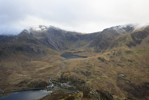
Glacial cirques in Snowdonia. The glacial lake (or tarn) in the cirque is Llyn Idwal. Note the higher, smaller cirque to the right of the image (Cwm Clyd).
A cirque is an armchair-shaped hollow high on a mountainside, often found on north facing slopes (in the northern hemisphere). They are the first places where glaciers would form at the start of a glacial period, and the last places where they would survive at the end of one. Cirques are also known as cwms, corries or coires. Cirque glaciers can be found in many mountain ranges at present, particularly those where glaciation is quite marginal, such as the Pyrenees. Evidence of them is also found in many previously-glaciated areas such as upland Britain.
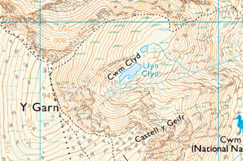
Caption: Extract of the 1:25000 Ordnance Survey map of Cwm Clyd in Snowdonia, North Wales (one of the cirques shown in the photo). Note the ‘horseshoe’ shape of the contours, which is characteristic of a cirque.
© Crown Copyright/database right 2014. An Ordnance Survey/EDINA supplied service.
Valley glaciers
Valley or Alpine or mountain glaciers are the most common type globally in terms of numbers, and they are the classic glaciers that most people would think of if asked what a glacier looks like. They are typically a few hundred metres to a few kilometres wide, and tens to hundreds of metres thick.
They occupy a valley in the mountains and are said to be topographically controlled, because their direction of flow is determined by the shape of the valley.
Examples of where valley glaciers are found include the Alps, the Andes, the Himalayas & New Zealand.
Ice caps
Ice caps are generally larger than valley glaciers (up to 50, 000 km2), and occupy the high ground of a mountainous area. Examples of where they may be found include Iceland, Svalbard, Patagonia, Norway and the islands of the Canadian High Arctic, such as Baffin Island.
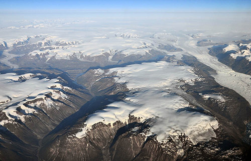
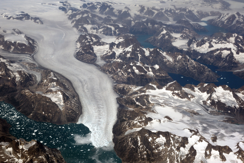
Small ice cap in East Greenland. The main Greenland ice sheet is seen in the background. Several valley glaciers are also visible, draining the ice sheet and the ice cap.
Photo credit: Frank Paul, University of Zurich
Ice sheets
The largest ice bodies are those known as ice sheets, which occupy a continental-scale area of greater than 50, 000 km2. There are just two ice sheets on earth at the moment; Greenland and Antarctica, but there have been more in the past. During glaciations (‘ice ages’) there were also ice sheets across much of Northern Europe, Scandinavia, North America and elsewhere.
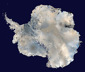
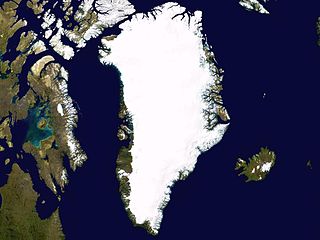
The Greenland Ice Sheet is about 1.7 million km2, and up to 3500m thick. The Antarctic Ice Sheet is about 14 million km2 and up to 4800m thick (NSIDC, undated). Together, they contain about 99% of all the freshwater on earth.
Because ice sheets store water above sea level (in the form of solid ice), they have the potential to massively affect sea level. If all the ice in Greenland melted, sea level would rise by about 6m. If the Antarctic Ice Sheet completely melted, it is thought that sea level would rise by about 60m (NSIDC).
Satellite image maps of Greenland and Antarctica (note, these images are not to the same scale. Antarctica is nearly 10 times the area of Greenland).
