The development of frontal theory
In the early years of the 20th century the science of meteorology had progressed to an understanding of the concept of distinctive air masses of different source origins. A leading and pre-eminent group of meteorologists established themselves in Bergen (Norway), led by Vilhelm Bjerknes and later his son, Jack Bjerknes. During the first decades of 20th century, the “Bergen School” (as they became known) developed ideas on frontal theory leading to some of the biggest advances in meteorology at that time (Roulstone and Norbury, 2013).
It was in Jack Bjerknes’ paper of 1919 (Bjerknes, 1919) and later Bjerknes and Solberg (1922) that the Bergen School first proposed the concept of weather “fronts”; that is, boundaries or discontinuities between air masses of significantly different origin. It was discovered that such discontinuities often brought cloud, wind and precipitation over fairly broad regions. These fronts were then designated according to what type of air mass followed them:
-

A “warm front” brought relatively warm conditions following its passage through an area.
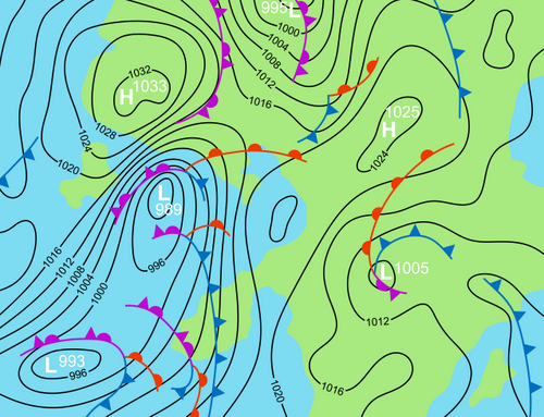
Figure 7: Warm fronts (indicated by red semi-circles), cold fronts (indicated by blue triangles) and occluded fronts (indicated in this image by purple semi-circles and triangles close together) are indicated on this weather map. Low and high-pressure weather systems are also depicted schematically.
-

A “cold front” brought fresher and cooler conditions (relative to normal for the time of year).
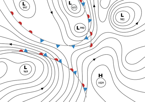
Figure 8: Illustration depicting how a cold front appears on a weather map
As an example:
- The arrival of a warm front in British Isles usually brings a warm or mild Maritime Tropical (mT) air mass.
- A cold front often brings a cooler and fresher Maritime Polar (mP) or Maritime Arctic (mA) air mass after its passage.