Occluded fronts and the synoptic weather chart
After the classification of warm and cold fronts, a third type of front was later proposed, known as an “occluded front” (see Figure). This type of front occurs when warm air gets lifted off ground level and gets wrapped around the centre of the low pressure system.
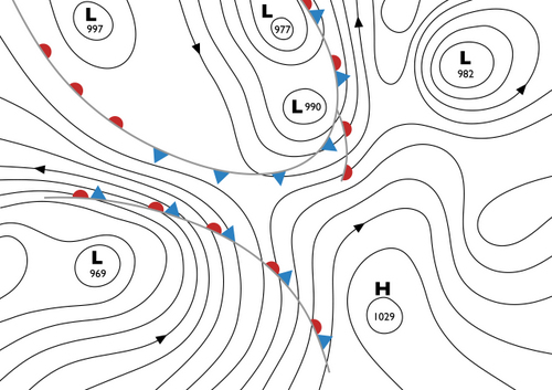
Although fronts are plotted as two-dimensional linear structures on weather maps (such as in Figure 8), in reality they are dynamic three-dimensional features, where the warm front “rides up” over the cooler air ahead of it, with a frontal gradient of about 0.5° to 1.0° (Barry and Chorley, 2010). Similarly, the cold air advancing in from behind a cold front often “undercuts” the warm air ahead of it, at a gradient steeper than that of the warm front, usually about 2° (Barry and Chorley, 2010). When the warm air has been completely lifted off the ground, the front is said to be “occluded”, although it continues to spiral into the centre of a low pressure system.
Warm, cold and occluded fronts are often depicted on the weather charts that we see on television and on online weather forecasts. When combined with an analysis of sea-level air pressure, these form what is called the “Synoptic Weather Chart”.
